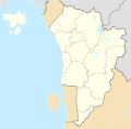
File:Kedah location map.svg

Size of this PNG preview of this SVG file: 606 × 599 pixels. Other resolutions: 243 × 240 pixels | 485 × 480 pixels | 777 × 768 pixels | 1,036 × 1,024 pixels | 2,071 × 2,048 pixels | 718 × 710 pixels.
Original file (SVG file, nominally 718 × 710 pixels, file size: 1.98 MB)
File history
Click on a date/time to view the file as it appeared at that time.
| Date/Time | Thumbnail | Dimensions | User | Comment | |
|---|---|---|---|---|---|
| current | 14:03, 15 Paenga-whāwhā 2020 |  | 718 × 710 (1.98 MB) | Zh9567 | Uploaded own work with UploadWizard |
File usage
There are no pages that use this file.
Global file usage
The following other wikis use this file:
- Usage on ceb.wikipedia.org
- Usage on cs.wikipedia.org
- Usage on en.wikipedia.org
- Kedah
- Sungai Petani
- Alor Setar
- Jitra
- Bukit Kayu Hitam
- Changlun
- Langkawi International Airport
- Gurun, Kedah
- Anak Bukit
- Kuah
- Wikipedia:WikiProject Malaysia/Cartography
- Sungai Lalang
- Module:Location map/data/Malaysia Kedah
- Module:Location map/data/Malaysia Kedah/doc
- Tenjong Dendang Formation
- Template:Kedah Labelled Map
- Relau, Kedah
- Usage on fr.wikipedia.org
- Usage on id.wikipedia.org
- Usage on ms.wikipedia.org
- Alor Setar
- UiTM Kampus Sungai Petani
- Kedah
- Pulau Rebak Besar
- Lapangan Terbang Antarabangsa Langkawi
- Lapangan Terbang Sultan Abdul Halim
- Peta
- Kupang, Kedah
- Pulau Selat Senari
- Pulau Singa Besar
- Pulau Lima, Langkawi
- Daerah di Malaysia
- FELDA Lubuk Merbau
- Mukim Sanglang, Kedah
- Pekan Kuala Sanglang
- Pekan Sanglang
- Mukim Belimbing Kanan
- Mukim Belimbing Kiri
- Mukim Padang Temak
- Pulau Bunting
- Sekolah Kebangsaan Mohd Ariff Abdullah
- Lapangan Terbang Antarabangsa Kulim
- Kampung Lalang, Baling
- Pulau Dangli
- Kampung Memali
- Modul:Peta lokasi/data/Malaysia Kedah
- Kampung Lubuk Legong
View more global usage of this file.